

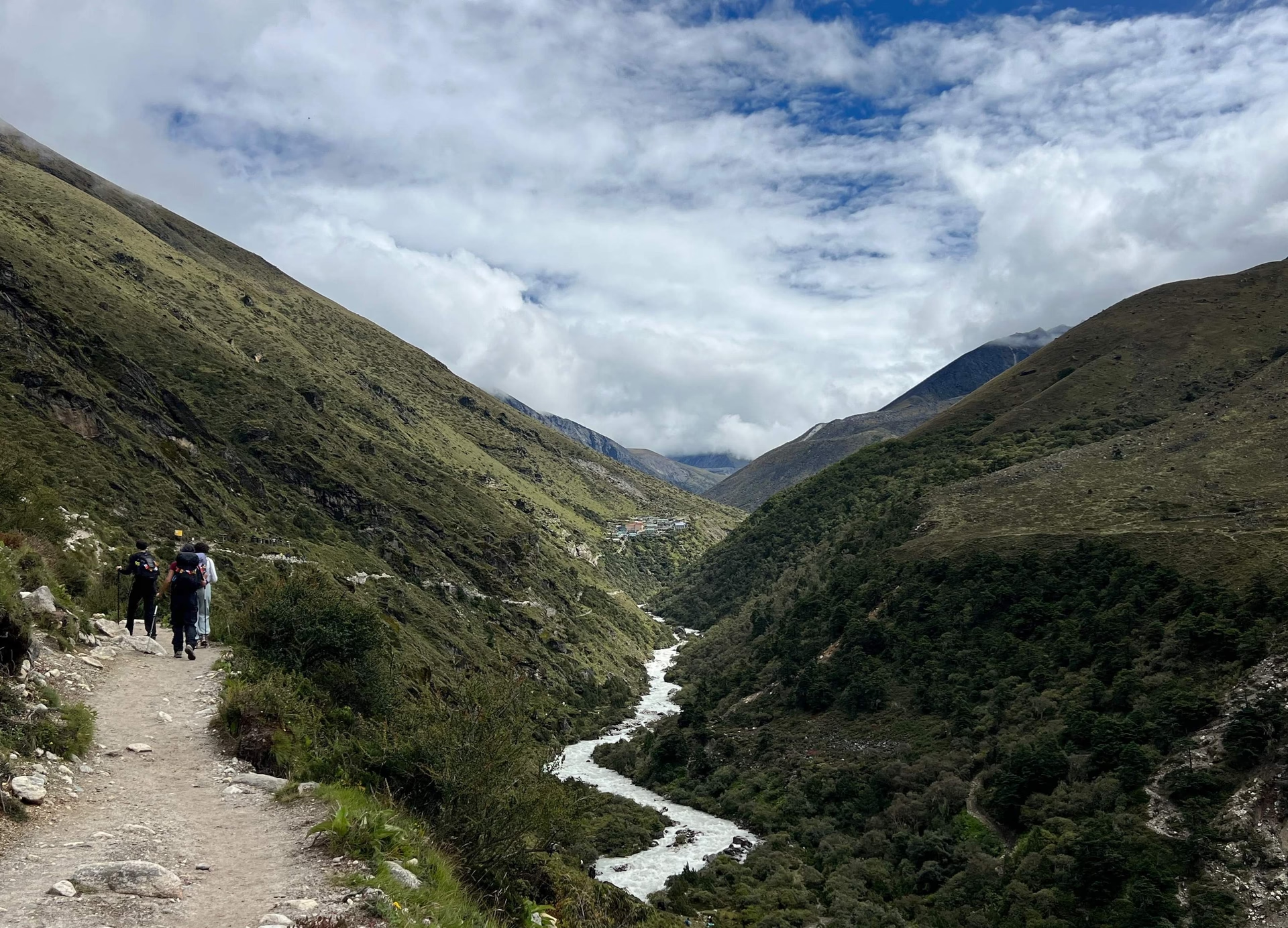
Understanding the Everest Base Camp Trek Route gives you the chance to do safe and successful trip. Yes, don’t trek to any places of Nepal without knowing much about it. Get details about the difficult sections, easy sections, attractions, accommodation, and different facilities present in the trail route before trekking. Today’s blog is about finding out different aspects of the Everest Base Camp Trek route which can be helpful for you to plan for this epic trekking adventure.
The whole adventure starts way before your boots ever hit the Khumbu dirt. If you book with us at Nepal High Trek during the busy spring or autumn seasons, expect a rough wake-up call. Almost all Lukla flights get diverted to Manthali Airport in Ramechhap to handle the sheer volume of climbers. That means crawling into a jeep around 1:00 AM in Kathmandu for a dark, bumpy four-hour road trip. You could head down the day before and grab a local hotel room, but most people just push through the night.
Once that tiny Twin Otter plane finally drops you onto Lukla’s terrifyingly slanted runway, everything changes. The air smells like pine and jet fuel. You are looking down the barrel of a 130-kilometer round trip. Gone are the days of needing a TIMS card. Instead, we grab the Pasang Lhamu Rural Municipality entry permit right there in town for NRs. 3000. Later on, we sort out the Sagarmatha National Park Entry Permit—NRs. 3000 for foreigners and NRs. 1000 for SAARC nationals. Bags get strapped to waiting zopkyos or porters carry your baggage. We grab a quick coffee. Then we finally start walking.

Everest Base Camp Trek: Leave Your Footprint at the World’s Tallest Base Camp
View detailsContents14
Lukla to Phakding: The First Transition from Roadside Life to Trail Life
Stepping through the Lukla gate feels oddly anticlimactic because the trail actually goes downhill. We spend the first few hours descending toward the roaring Dudh Koshi River. The walking is easy. Packed dirt. Gentle stone steps. This is the first section of the trek and you can enjoy the trail as there are no harder sections.
It is humid down here. Pine forests throw thick shade across the path, and we pass endless stone walls carved with Tibetan prayers. You spin a few brass prayer wheels for luck and dodge the occasional loaded mule train. We normally push a relaxed pace to Phakding, stopping to let everyone soak in the transition. The tea houses smell intensely of woodsmoke and boiling dal. It really just feels like a rugged countryside hike. This gentle start is entirely intentional, letting our legs remember how to walk all day without throwing brutal altitude at us right away.
.avif)
The Monjo–Jorsale Section: Where the Everest Route Enters Its High-Mountain Character
Leaving Phakding means crossing our first high suspension bridges. The cables bounce and sway over a river that looks like churning milk. By the time we hit the checkpoint at Monjo to show our national park permits, the valley walls have closed in completely. Note down that the section is where you enter the Sagarmatha National Park. The second day’s lunch place is also in this section. Please note down that there are few landslide sections in this part of the Everest Base Camp Trek route. Near Jorsalle and Benkar areas, there are damp pine forests areas on the banks of river where you may find few landslide sections.
The soft pine hills are gone. Sheer, dark rock faces block out the morning sun. The trail drops sharply down to Jorsale, the last place to buy a snack before the real work begins. We walk along the riverbed until the famous Hillary Suspension Bridge comes into view, hanging impossibly high above the gorge, completely tangled in faded prayer flags. The wind hitting your face on that bridge carries a sharp, undeniable chill. The easy valley stroll is over. The high mountains have officially arrived.
Why the Namche Climb Feels Harder Than Its Distance Suggests?
Looking at a map, the stretch from the river up to Namche Bazaar looks short. It lies. That hill kicks everyone’s teeth in. We are talking about a relentless, dusty zig-zag cutting straight up the mountain to gain 600 vertical meters. If weather is nice, you can also get the first view of Mount Everest in this section. Near the Namche Check Post of the Sagarmatha National Park, there is a resting place with washroom, you can get the first glimpse of the mountain from here. Watch out for wild birds especially Himalayan Monal in this trail section.
It hurts because we are crossing the 3,400-meter mark. The oxygen is thinning out fast, and every single step upward demands two deep breaths. Dust coats the back of your throat. We lock into a slow, monotonous plod just to keep the heart rate from exploding. Walking into the horseshoe-shaped bowl of Namche feels like a massive victory. Spending an extra acclimatization day here is the only way we keep altitude sickness from ending the trip early.
The first acclimatization happens in this town. Trekkers hike to the Everest View Hotel (3880 m) and return back to Namche for overnight sleep. Note down that the acclimatization is same for different types of treks in the region from Everest Three High Passes Trek to the Gokyo Lake Trek. All treks in the region have this day in their itinerary for safety purpose. Adjusting to the demands of higher elevation places is very important for proper and safe trek.

Gokyo Lake Trek
View detailsNamche to Tengboche: The Route’s Most Scenic Ridge-and-River Section
We drag ourselves out of Namche and hit what might be the best walking of the entire trek. The trail flattens out into a wide balcony carved right into the side of the mountain. The views hit you instantly. Everest, Lhotse, and Ama Dablam are just sitting there, massive and completely unobstructed against the blue sky.
The sun bakes the dirt path. It feels glorious. But the Khumbu never gives you free miles. The trail takes a nasty, plunging dive back down to the river at Phunki Tenga. We lose all that hard-earned altitude in an hour. After crossing the bridge and grabbing some hot tea, the trail points straight back up. It is a grueling, two-hour slog through heavy rhododendron forests. The dirt turns to loose gravel that slides under our boots. Pushing over the final crest into Tengboche, with its brightly painted monastery sitting in the shadow of Ama Dablam, makes you forget the pain entirely.
Tengboche to Pangboche: Following the Imja Khola Toward Higher Valleys
Mornings in Tengboche are freezing. We pack up quickly and head down a damp, shadowed trail cutting through a weirdly beautiful forest of birch and drooping moss. The descent brings us right to the edge of the Imja Khola river. Once we cross that freezing water, the landscape fundamentally shifts. The comforting trees just give up and disappear. We are left walking through pale alpine scrub and scattered rocks.
The trail points up the valley toward Pangboche, the highest permanent farming village out here. A nasty headwind usually rips straight down this corridor, slicing right through whatever fleece you put on that morning. The stone walls of the tea houses look thicker. The windows are smaller. Everything out here is built to survive the bitter cold, and we can feel the isolation creeping in.
Dingboche or Pheriche: Understanding the Two Route Options
Just past Pangboche, the trail hits a fork. Go left for Pheriche. Go right for Dingboche. We almost always take our groups up to the right toward Dingboche. From Somare Village, the trail starts to enter more barren areas. It just makes more sense for acclimatization if you take the Dingboche village route.
Dingboche sits slightly higher and gets bathed in sunlight, tucked away from the absolute worst of the afternoon winds. It also gives us direct access to Nangkartshang Peak. We use that punishing side trail to force our bodies up to 5,000 meters before coming back down to sleep. Pheriche sits lower on the valley floor. It acts like a wind tunnel and gets insanely cold the second the sun drops. Pheriche is vital because it holds the Himalayan Rescue Association clinic, but for resting and adapting to the thin air, the sunny stone walls of Dingboche win every time.
The Thukla Section: Where the Landscape Suddenly Becomes More Rugged
Walking out of Dingboche feels like stepping onto another planet. We cross a massive, wide-open alpine plateau. The grass is completely dead and brown. Massive peaks loom directly over our shoulders, blocking out the horizon. We eventually hit Thukla, a tiny cluster of lodges shoved against the bottom of a huge, ugly wall of loose rock. That wall is the terminal moraine of the Khumbu Glacier, and climbing it is awful.
The Thukla Pass is steep, slippery, and absolutely suffocating in the thin air. You hit the top gasping, but the mood changes instantly. We walk into the Chukwu Lya memorial. Dozens of stone shrines sit quietly in the freezing wind, built for the climbers who never came down from Everest. It is dead silent up there, except for the wind tearing at the prayer flags. The dirt is gone. We are in the ice and rock now.

Everest View Trek
View detailsLobuche to Gorak Shep: Walking into the Khumbu Glacier Landscape
If you want to know where the Everest trek gets genuinely mean, this is it. Leaving Lobuche, we stop walking on normal trails and start navigating the chaotic lateral moraine of the glacier. It is an exhausting, ankle-rolling mess. We scramble over jagged boulders, slide down loose scree slopes, and drag ourselves out of deep, icy dips.
At 5,000 meters, your body is begging for oxygen that just isn't there. A dull headache is pretty much guaranteed. The air is so dry it makes you cough constantly. We fight for every single mile until the trail mercifully drops into Gorak Shep. It is a bleak, sandy frozen lakebed completely boxed in by towering walls of dirty ice and black rock. The Gorakshep village is the last stop before we reach the Everest Base Camp. Check our blog about sleeping in Gorakshep Village to find more about conditions in this place located in the foothill of Kalapathar (5545 m).
Gorak Shep to Everest Base Camp: Why the Final Trail Is Different from Earlier Sections?
Dropping our heavy bags in Gorak Shep, we immediately turn toward Base Camp. It isn't a steep climb, but it is by far the most technical walking of the entire trip. We step right onto the living Khumbu Glacier. There is no permanent path here. The ice melts, moves, and shatters every season, taking the trail with it. We follow wobbly rock cairns, picking our way across moving boulders and solid blue ice.
Sometimes you hear a deep, terrifying crack echoing from somewhere underneath your boots. We step carefully, terrified of twisting an ankle this close to the end. We round a massive chunk of ice, and there it is. The yellow tents scattered across the freezing rubble right below the terrifying Khumbu Icefall. If it is the climbing season, then the base camp seems like a market of colorful tents.
We stop in big boulder with the Everest Base Camp sign and enjoy our final destination on the Everest Base Camp Trek route journey.

Lobuche Peak Climbing
View detailsHow the EBC Route Changes from Green Valleys to Glacial Terrain ?
The shift sneaks up on you. Down low near Lukla, you are sweating through your shirt in lush, heavy pine forests. The air smells like wet earth. By Namche, the massive trees are gone, replaced by shorter, tougher pines. Push past Tengboche, and the tree line totally vanishes. You walk through knee-high scrub brush and yellow alpine grass.
Then you haul yourself up the Thukla Pass and the color green ceases to exist. The entire world turns violently monochromatic. It is just gray granite, blinding white snow, and deep blue sky. The humidity flatlines. The packed dirt you enjoyed on day one gets replaced entirely by loose, shifting glacial rubble that demands you watch every single step.
.avif)
The Hidden Role of Side Trails on the Standard Everest Base Camp Route
Walking the main trail isn't enough to get you to Base Camp safely. The side hikes are the actual secret to surviving the altitude. That steep, awful climb up to the Everest View Hotel above Namche forces your lungs to handle 3,800 meters before we drop back down for dinner. The nasty scramble up Nangkartshang Peak in Dingboche drags you to 5,000 meters.
The pre-dawn, freezing march from Gorak Shep up the black rock of Kala Patthar is actually the highest point of the whole trek at 5,545 meters. We do these hikes because the body only builds red blood cells when you stress it. You have to climb high and sleep low. Skipping these side trails is the fastest way to guarantee a helicopter ride back to Kathmandu.
Where Trekkers Gain the Most Elevation on the EBC Route
The steepest, most relentless elevation punch happens on the dirt wall leading up to Namche Bazaar. We gain over 600 meters in a few hours of totally breathless switchbacks. The Kala Patthar hike is the other major shock to the system. You drag yourself out of bed in the pitch dark at Gorak Shep and climb nearly 400 vertical meters straight into the sky.
The distance is short, but the air is so unimaginably thin that it feels like climbing a ladder underwater. The Thukla Pass is the third major hurdle. It is a sudden, rocky, brutal ramp that violently kicks you up to a new altitude tier just when your legs are starting to feel heavy.

Three High Passes Trek
View detailsWhy the Return Route Feels Different Even When You Retrace the Same Trail
Turning around and walking downhill should be a breeze, but it feels like an entirely different universe. First off, your body is completely starved for oxygen, and every step down floods your system with the good stuff. You feel insanely strong. We absolutely fly down the trail, covering in three days what originally took us eight days to climb.
The air gets noticeably warmer by the hour. We finally strip off the heavy down layers. But the descent destroys your knees. And all those flat sections you barely noticed on the way up? They suddenly reveal nasty little uphill grinds that absolutely wreck your morale when you are exhausted and just want a hot shower in Lukla.
Everest Base Camp Route Variations: Classic Trail, Gokyo Connection and Three Passes
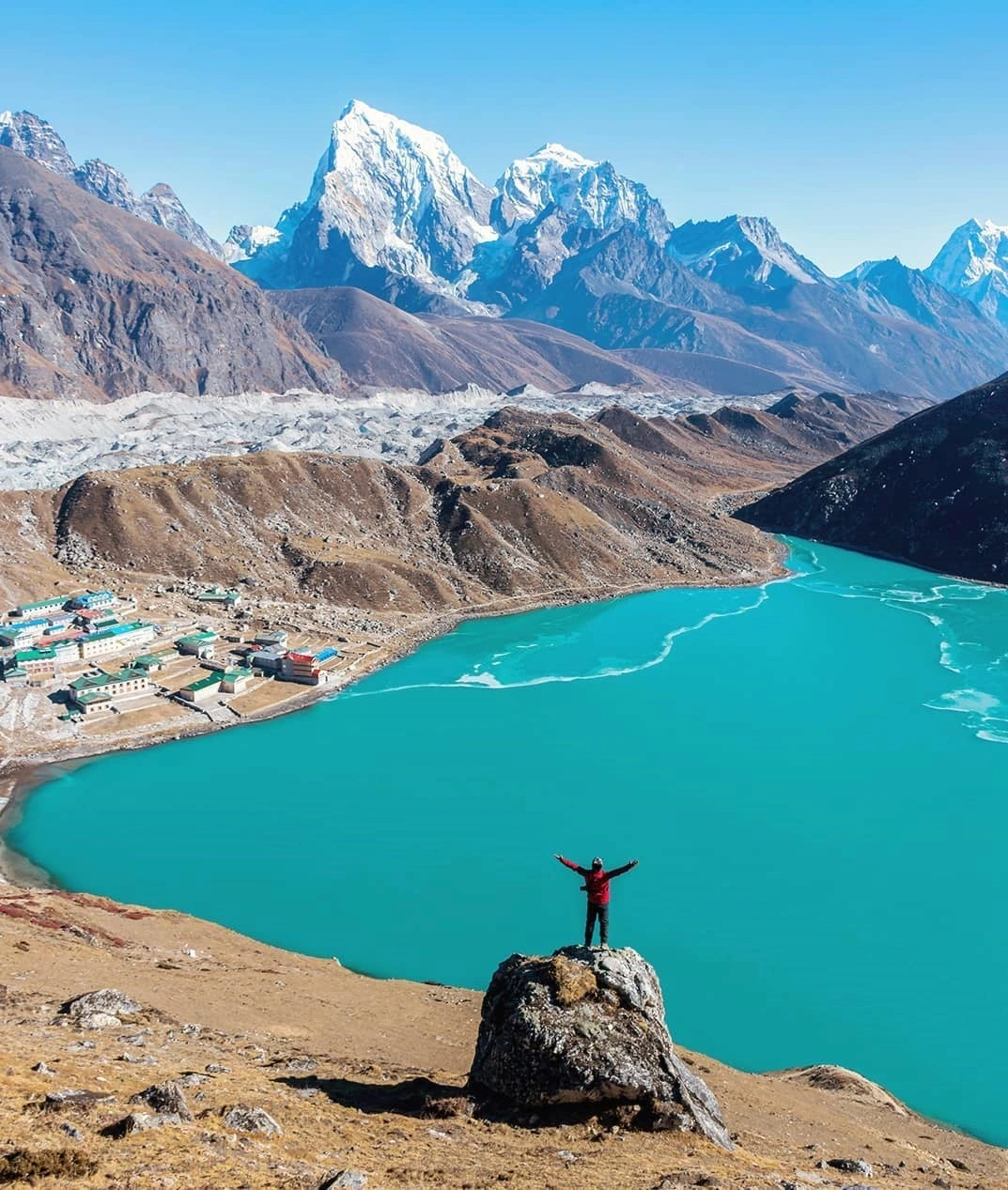
Most people stick to the classic out-and-back trail because it is straightforward and has the best tea house infrastructure. But a lot of trekkers peel off the main highway at Namche to hit the Gokyo Lakes. We walk through a stunning, quiet valley filled with vibrant turquoise water, then drag ourselves over the brutal, icy Cho La pass to reconnect with the Base Camp trail at Lobuche. If you really want to test your perseverance, there is the Three High Passes Trek. We link the Gokyo Lake with Renjo La, Cho La 5357m, and Kongma La Pass 5420m together. It is an absolutely savage, exhausting loop that tags Base Camp but keeps you incredibly high, freezing, and off the crowded main trail for almost the entire trip. For more off the beaten course, you can try the Ama Dablam Base Camp Trek too.
Please note down that the Everest Base Camp Trek route is also in the trail to reach different mountains. Climbers use the same route to go on the journey of the Island Peak Climbing and Lobuche Peak Climbing.
Frequently asked
Nepal High Trek
Travel writer and passionate explorer sharing stories and expert guides from the heart of the Himalaya.