
Nepal High Trek
Contact Us

Tilicho Base Camp to Tilicho Lake

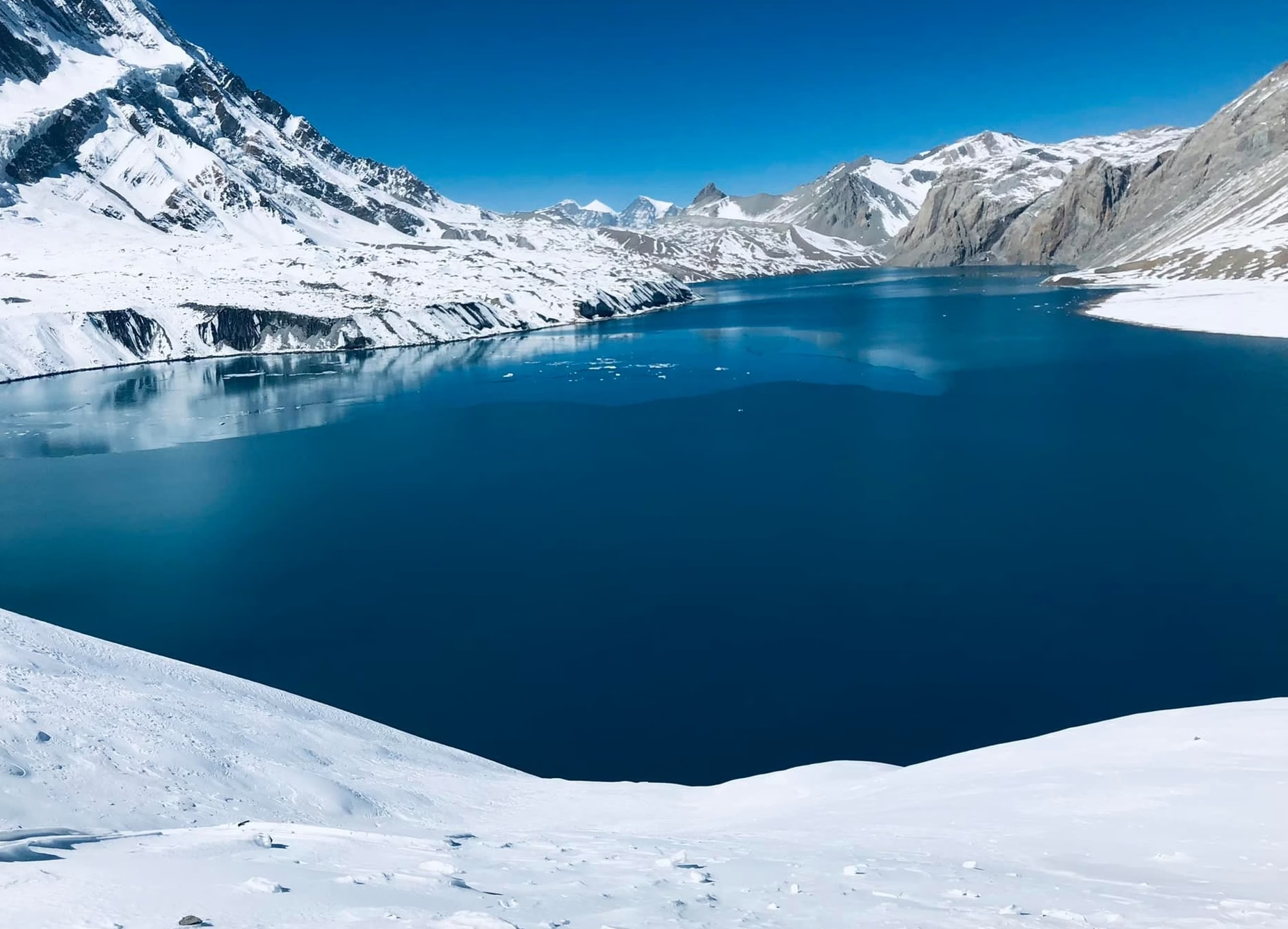
The journey from Tilicho Base Camp to Tilicho Lake (4919 m) is one of the most spectacular high-altitude adventures in Nepal’s Annapurna region. Starting from Tilicho Base Camp at approximately 4,150 meters, the trail climbs steeply through rugged, barren Himalayan terrain to Tilicho Lake at 4,919 meters. Surrounded by numerous dramatic snow-covered peaks, the turquoise lake rewards trekkers with extraordinary mountain scenery and a true sense of wilderness. This challenging side trip of the Annapurna Circuit requires good fitness, proper acclimatization, and an early start.
Nepal High Trek
AuthorNepal High Trek
Published
Updated
Reading Time12 min read
Share
Tilicho Base Camp to Tilicho Lake

On the way of the Annapurna Circuit Trek route, you can take on the best side treks ever! Yes, I am talking about the Tilicho Lake Trek in Nepal from Manang Village. There are lots of articles and packages that you will find in this trekking scenario, where travelers reach the world’s highest situated fresh water lake, the Tilicho Lake (4919 m). Nobody tells you that the journey is treacherous and it is one of the most challenging sections of the Annapurna Circuit Trek with Tilicho Lake in Nepal. Today’s blog is about decoding what is it like to trek from Tilicho Base Camp to Tilicho Lake. Please note down that the Tilicho Base Camp is the last human settlement before you explore the lake.

We don’t write blogs just to fill up the quota as per the travel website guideline! Our main focus is to make sure that you are well aware of places where you are visiting. If you know about different aspects of the host destination, then you can knit the best travel experiences and get back worth of every penny spent. Where do you get the best Tilicho Lake trekking itinerary and package? Don’t look further than the Nepal High Trek, the number one trekking company of Nepal to book the Tilicho Annapurna Circuit Trek journey in Nepal. Yes, the company ensures that you are safe and your travel investment is well spent!

In this blog, we will talk about the difficulty, cost, trail conditions, challenges, accommodation, altitude sickness, and meals, and miscellaneous things about the Annapurna Circuit Trek with Tilicho Lake. Note down that we will give more focus on the Tilicho Base Camp to Tilicho Lake section. It is the most crucial section of our trekking journey in this part of the world.

Tilicho Base Camp: The Starting Point

One thing you must know about the Tilicho base Camp is that the place is not a luxury travel destination.  It’s a windswept collection of stone lodges huddled at 4,150 meters, smelling faintly of kerosene and nervous sweat. You wake up before dawn and head to the shores of the Tilicho Lake. The trail is not easy as you trek uphill in the winding trail in the landslide like terrain! The valley looks so intimidating but once you reach Tilicho Lake shores, the tiredness vanishes. Note down that you have to stay an overnight from Manang Village before you reach Tilicho Base Camp. The place is the last place where you spend overnight before reaching the lake.
3cc0234f-be8c-4daf-864e-efb74d085310-(copy-02).avif
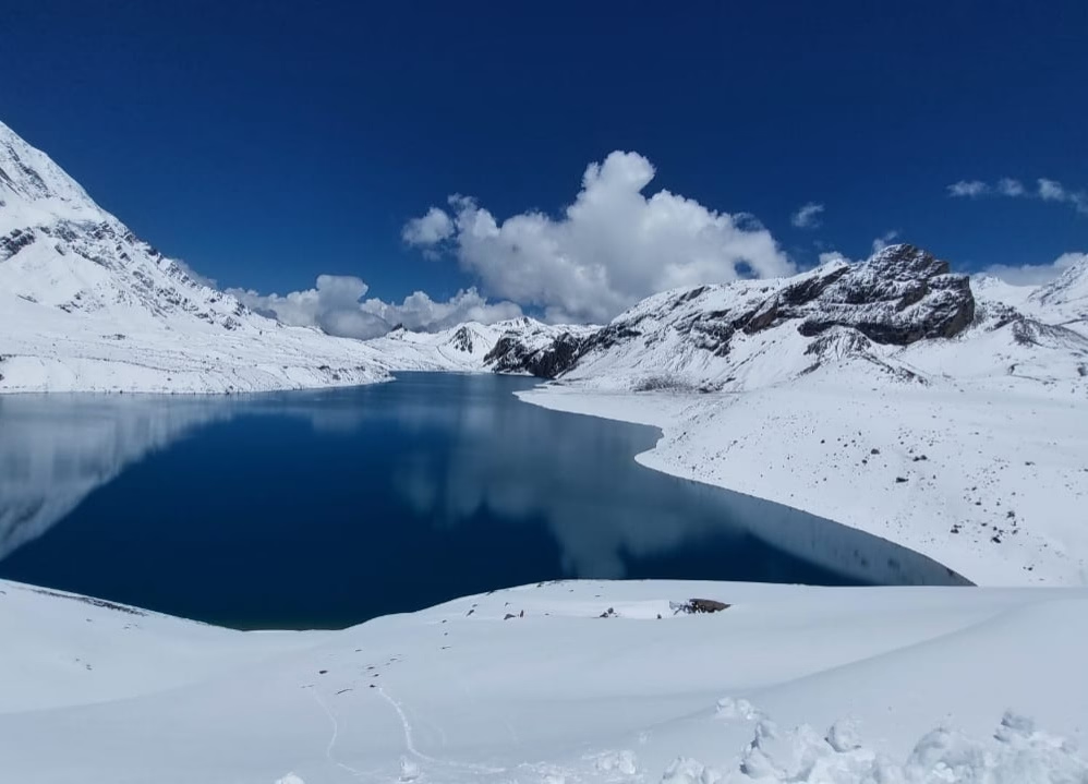
Tilicho Lake 4919m

What to Expect on the Trail to Tilicho Lake?

Seriously, expect your legs to scream almost immediately. The path kicks off with a ruthless series of switchbacks that will absolutely humble you. You’ll be gasping for air within the first ten minutes, staring up at a seemingly endless zigzag of dirt. That said, it’s not all just a brutal slog. Eventually, the trail levels out a bit, wrapping tightly around steep scree slopes where a single misstep sends loose pebbles clattering down into the abyss below. In fact, it surely tests your perseverance and endurance level. If you are thinking about the next Thorong La Pass crossing after exploring the place, then you may feel overwhelmed. Please understand that you can skip the famous Thorong La Pass too from this route. You can reach Jomsom or the Mustang Valley by crossing Meso Kanta La Pass instead of taking the Thorong La Pass route of the Annapurna Circuit Trek trail.

Distance and Elevation from Tilicho Base Camp to Tilicho Lake

Numbers on a map lie. The distance is only about five kilometers each way, which sounds completely manageable until you factor in the absurd vertical math. Here's the catch that you must not ignore and you are hauling yourself from 4,150 meters up to nearly 5,000 meters. That is roughly 800 vertical meters of sheer, lung-busting suffering crammed into a painfully short stretch of rocky earth. Every single foot of elevation gained feels like dragging a cinderblock behind you.
How Long Does It Take to Reach Tilicho Lake?

It varies wildly. A freakishly fit trail runner might bounce up there in two hours, but for regular humans the trek timing and distance vary? Plan on three to four hours of agonizingly slow progress. You simply can't rush this. The thin air forces a snail's pace, making you stop every twenty steps just to stop the world from spinning. Honestly, time gets weird up there. What feels like an hour of uphill grinding might only cover a few hundred meters of actual trail. Just accept the turtle pace. Listen to your body, let the faster folks pass, and eventually, the frozen water will appear.

Best Time to Hike from Tilicho Base Camp to Tilicho Lake

Mountain weather turns nasty with zero warning. By late morning, fierce winds typically come howling down the valley, turning a challenging hike into a miserable, bone-chilling fight for survival. Besides, the morning light hitting the surrounding peaks is pure magic. If you try to sleep in and start around nine, you'll be wrestling with gale-force gusts and dodging afternoon clouds that completely obscure the lake. Don't be lazy. Set that alarm. Make sure that you start the trek early in the morning from Tilicho Base Camp to Tilicho Lake. It is to make sure that you return from the lake and travel further to continue pushing for the Thorong La Pass Trek in Nepal.

The Trail from Tilicho Base Camp to Tilicho Lake

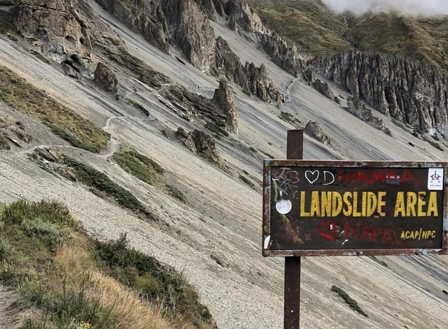
It’s sketchy. You spend a good chunk of time traversing what feels like an oversized gravel pit tilted at a forty-five-degree angle. These landslide zones are notorious. There are no guardrails, no handholds, just a narrow foot-wide groove stamped into loose, sliding dirt. You find yourself leaning into the mountain, trusting your trekking poles with your life. The trail is rugged and you will feel overwhelmed while walking in this trekking route.
27377711-700x525.avif
On the way to Tilicho Base Camp

High-Altitude Challenges on the Trail

Breathing feels like sucking air through a crushed straw. That’s the reality of hiking near 5,000 meters. Every tiny movement, like tying a loose shoelace or shrugging into a heavy jacket, leaves you panting heavily. The cold up here isn't just chilly; it's a biting, aggressive freeze that cuts right through expensive gear if you stop moving for too long. Dehydration sneaks up on you, too. You don't feel thirsty in the freezing wind, but your body is losing moisture rapidly with every ragged breath. You have to force yourself to drink icy water, fighting a constant, mild nausea.

All these things mentioned above are true! However, if you choose to travel in these parts of Nepal with us, then we will make sure that you have a wonderful time. Additionally, we offer the best prices and itineraries for travelers to choose according to their preferences.

Reaching Tilicho Lake during the Annapurna Circuit Trek in Nepal

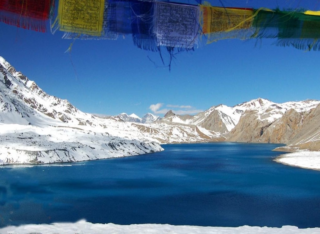
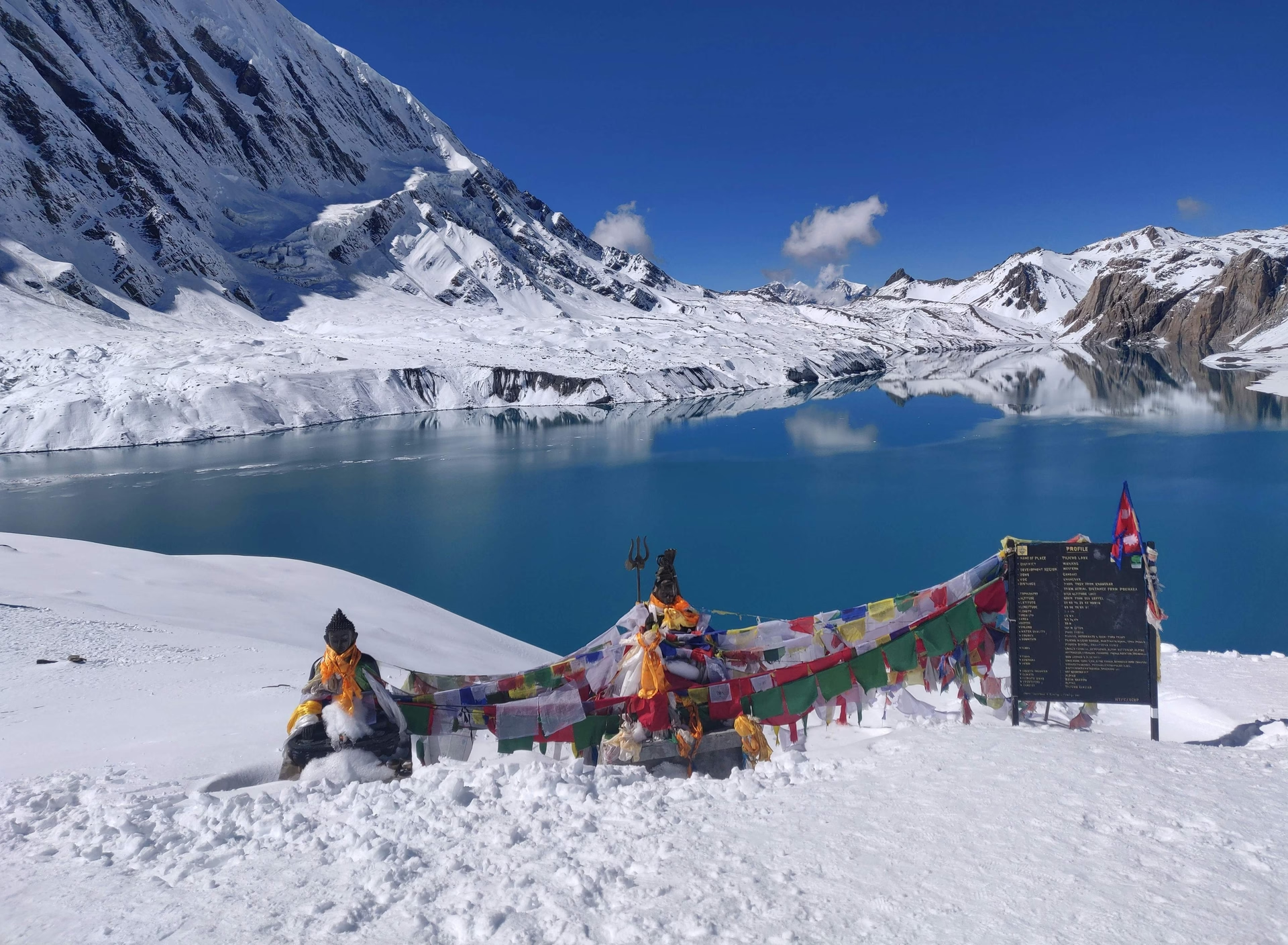
Suddenly, the trail flattens out, and there it is. A massive, impossibly blue body of water sitting in a frozen crater at the top of the world. The wind usually whips across the surface, kicking up tiny ice waves. It feels surreal. You stand there, shivering violently in your sweat-soaked base layers, staring at this giant sapphire locked in ice and stone. The relief of finishing the climb washes over you, quickly followed by the harsh realization of how incredibly cold it is. You did it. Against all the odds and the burning muscles, you actually made it.
The construction of roads in the Manang district of Nepal especially inside the Annapurna Circuit Trek route of the ACAP has eroded the charm of authentic trekking. Therefore, we try our best to makes sure that you are enjoying the authentic experiences but not the fluffy travel documentaries. Many travelers have started to inquire about the Manaslu Circuit Trek route as an alternative to the Annapurna Circuit Trek route due to the construction of roads. The option to do the Tilicho Lake Side Trek is an ideal way to enhance the overall trekking experiences.

What to Do at Tilicho Lake?

Take pictures fast. Your fingers will go completely numb within minutes if you take your gloves off to fiddle with a camera or phone. Find a large rock to hide behind, out of the punishing wind, and chug some hot tea from your thermos. Honestly, there isn't much to "do" besides survive the cold and soak in the raw, unforgiving atmosphere. You might hear the thunderous crack of an avalanche on the far side of the lake, echoing off the icy walls. Sit in silence for a bit. Absorb the isolation, eat a snack, and prepare to leave.

Returning from Tilicho Lake to Tilicho Base Camp

Going down is honestly worse. Sure, your lungs finally get a break, but your knees will take an absolute beating. The steep, loose scree that you struggled up earlier is now a massive slip-and-slide of jagged rocks. You have to plant your poles firmly and slide your heels to brake, trying desperately not to wipe out in front of everyone. It’s mentally exhausting. Your legs are already like wobbly jelly from the ascent, making every step down feel shaky and uncertain. By the time you finally see those blue roofs again, all you'll want is hot soup.
9da42911-eb77-4d37-b81a-0db61bd497b4.avif
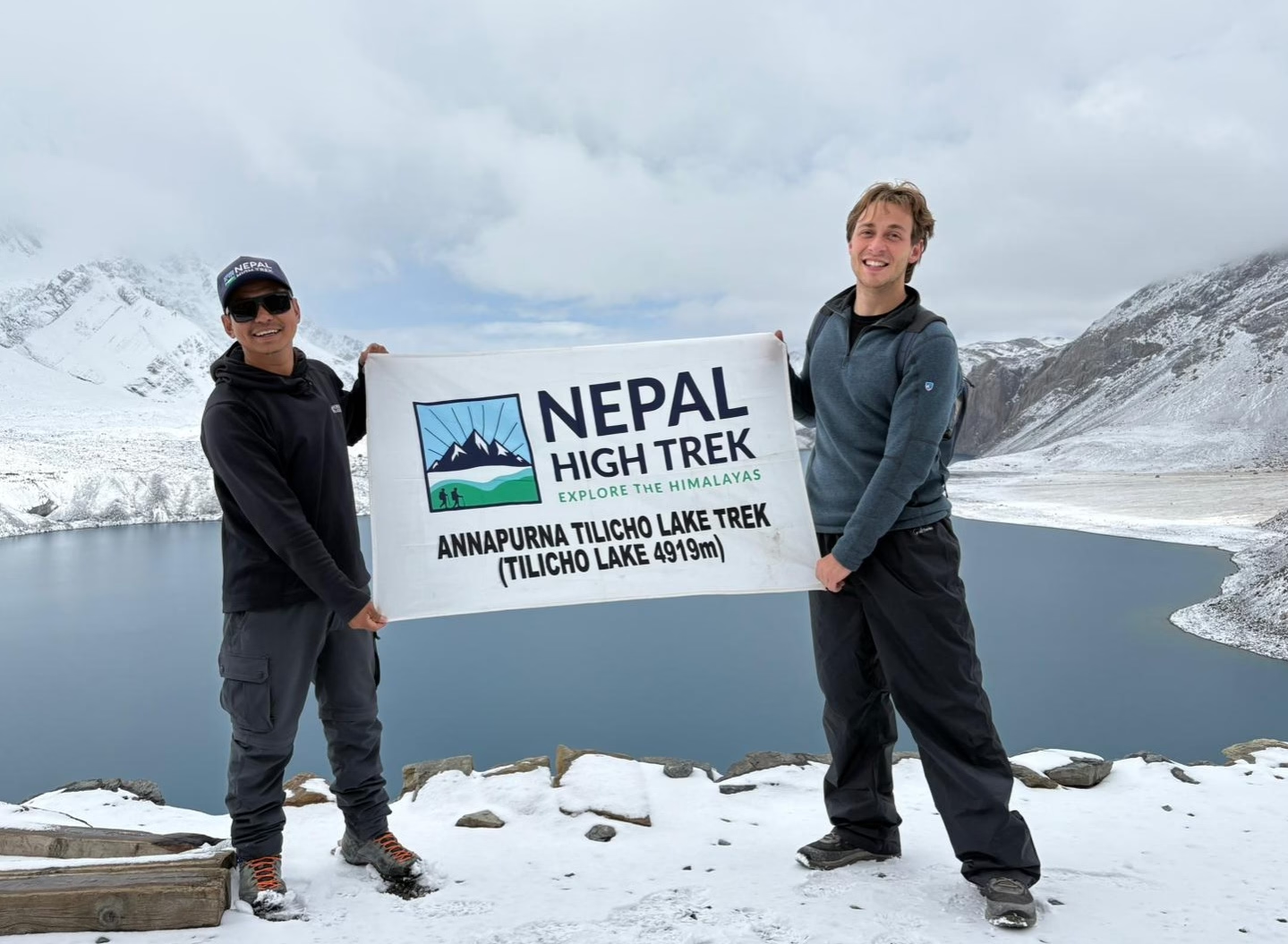
An amazing view of Tilicho Lake

How difficult is the hike from Tilicho Base Camp to Tilicho Lake?

It’s a brutal grind that requires considerable amount of physical fitness level and cardio – vascular abilities. After the construction of roads in the region, people are searching for alternative trails. Therefore, the inclusion of the Tilicho Lake Trek and the Nar Phu Valley Trek in the original Annapurna Circuit Trek with Thorong La Pass is understandable. Do not underestimate this trail just because it’s a popular side trip on the circuit. You are dealing with extreme altitude, treacherous landslide zones with sheer drops, and a relentless uphill battle on loose gravel. You need solid fitness. But more importantly, you need mental grit, because your brain will definitely tell you to quit halfway up that very first set of switchbacks. Push through it.

How far is Tilicho Lake from Tilicho Base Camp?

You are looking at roughly five kilometers each way. Ten kilometers total trekking distance must be covered by a trekker when on the journey of the Tilicho Base Camp to Tilicho Lake. That sounds pretty short, doesn't it? Well, don't let the mileage fool you. When you're climbing up that steep, oxygen-deprived terrain, a single kilometer feels like an absolute marathon. The distance is completely overshadowed by the massive vertical gain you have to conquer. It takes hours of slow grinding to cover that tiny stretch of land.
How long does it take to hike from Tilicho Base Camp to Tilicho Lake?

Figure on three to four hours for the agonizing ascent, and maybe two hours to scramble back down. If you are struggling hard with the altitude, it could easily take five hours just to reach the freezing water. Look, it isn't a race and make sure that you heed the instructions of your trekking guide. Don’t try to look tough especially during this type of higher elevation trekking trip. Rushing only invites physical disaster up there, so plan for a grueling five to six-hour round trip at a very slow, highly cautious pace.

What is the elevation of Tilicho Lake ?

It sits at a dizzying 4,919 meters. That is over 16,100 feet. Your body will definitely notice the severe lack of oxygen up there, making you feel slow, heavy, and slightly lightheaded even when standing still. It’s one of the highest lakes in the entire world, which is exactly why dragging your boots all the way up there feels like such a massive, lung-crushing achievement.

Do you need a guide for the Tilicho Lake hike?

You don't strictly need one, as the foot path of the Annapurna Circuit with Tilicho Lake Trek in Nepal is mostly obvious. That said, having a local guide is a massive safety net. They know exactly how to navigate those sketchy scree slopes, can read the rapidly changing weather, and will spot the early signs of altitude sickness long before you realize your minor headache is actually becoming a serious, life-threatening problem.

Is altitude sickness a concern on the Tilicho Lake trail?

Don’t underestimate the threat of the altitude sickness in this trekking journey. The trip is beyond 3500 m and it is in fact above 4000 m which is highly risky for altitude sickness. It’s the biggest danger you face out there on the dirt. Going from 4,150 meters to nearly 5,000 meters in just a few short hours puts intense stress on your entire body. You have to monitor yourself constantly. If you get a severe headache, start vomiting, or lose your coordination, you have to turn around and descend immediately, no matter how close you are to the top.

Frequently asked
1. Get the best Nepal Government Licensed Trekking Agency 2. Ask for copies of all the required documents of the agency to avoid any kind of fraudulence 3. Consult about acclimatization, itineraries, and services included in the trek package. 4. Inform your physical fitness level and previous trekking experiences in high-altitude places. 5. Once agreed on trip details (Package includes, excludes, and Itinerary), send the Trip Advance Costs – Usually Advance Deposit is 20 – 25 % of the trip cost 6. Send your valid passport copies and PP sized Photographs 7. Send your Flight Schedule so that the agency can pick you up from the airport 8. Get the Travel Insurance with a policy that includes emergency helicopter rescue, medical expenses, accidents, and trip cancellations 9. Ask for accommodation confirmation from the agency 10. Ask for the Advance Deposit Receipt

Tipping is customary in Nepal and is appreciated by guides, porters, and support staff as a gesture of gratitude.

Accommodation is mainly in teahouses and guesthouses, typically offering twin-sharing rooms and basic facilities.

Yes, absolutely, combining the main circuit with side trips like Tilicho Lake or Poon Hill creates the ultimate Himalayan trekking experience if you have the extra time. Tilicho Lake sits at a dizzying elevation of 4,919 meters and is one of the highest alpine lakes in the world. To visit it, you branch off the main circuit trail shortly after Manang, heading through a dramatic, landslide-prone valley to stay at Tilicho Base Camp before making the steep early-morning push to the turquoise, glacier-rimmed lake. This side trip adds 2 to 3 days to your overall itinerary, but it serves as a phenomenal high-altitude acclimatization builder before you tackle Thorong La Pass. On the back end of the pass, after descending into the Mustang Valley and visiting Muktinath, you can choose to extend your trek southward toward Poon Hill (3,210m) instead of taking a jeep straight to Pokhara. By continuing down through the lush rhododendron forests of Tatopani and Ghorepani, you can climb Poon Hill for one of the most famous sunrise panoramas in Asia, where the sun illuminates the massive snowcapped walls of both the Annapurna and Dhaulagiri ranges. Adding both Tilicho Lake and Poon Hill turns the standard circuit into a grand 18-to-20-day mega-trek that showcases every single landscape layer Nepal has to offer. Please contact the bloggers of the Nepal High Trek to make sure that you have a hassle - free trek in Nepal! Even if you know all things about trekking activities, it is important to travel with the experts. We are definitely one of the best trekking agencies of Nepal that provide value of every penny spent for the trek investment! Follow our blogs to understand about what, how, where, when, and why about trekking in Nepal. Subscribe our newsletters and blogs to find out honest reviews and information about traveling to Nepal. So, the answer to the question “Is the Annapurna Circuit Trek Worth It In 2027?” is simply absolutely yes! Book the trek package and embark on this amazing journey!

Modern infrastructure along the Annapurna Circuit is surprisingly advanced, so you won't be completely cut off from the outside world. Almost every tea house from the lower foothills up to Manang offers Wi-Fi, usually powered by satellite networks or local broadband providers. Lower down, Wi-Fi is often free, but as you climb above 3,500 meters, lodges usually charge a small flat fee ($2 to $4 USD) for access. Keep in mind that connection speeds can slow down significantly in the evenings when dozens of cold trekkers are all trying to load videos at the same time in the communal dining hall. Electricity for charging your devices is widely available, though it operates on a similar pay-per-use model higher up the trail. Lower tea houses often have free wall outlets in the private bedrooms, but higher camps rely on solar panels and generators, charging $2 to $5 USD to top up your phone, camera batteries, or power bank in the main hall. Cell service via local SIM cards (NTC or Ncell) works surprisingly well through most of the lower valleys and major hubs like Chame, Manang, and Jomsom. However, signal coverage becomes spotty or completely drops out in narrow river gorges, near Tilicho Lake, and on the high approach to Thorong La Pass.

Successfully managing altitude sickness (Acute Mountain Sickness, or AMS) during the crossing of Thorong La Pass comes down to strict, disciplined preparation long before you reach the base of the pass. The most critical factor is your acclimatization schedule: you must spend at least two full nights resting and doing active day-hikes in Manang (3,540m) to allow your body to adapt to the lower oxygen levels. The golden rule of high-altitude trekking is to "climb high, sleep low." Take slow, deliberate, rhythmic steps on the trail—if you are breathing so hard that you cannot hold a basic conversation, you are moving too fast. Hydration and early detection are your best defenses against severe altitude issues. You should drink 3 to 4 liters of clean water every day, completely avoid alcohol and sleeping pills, and eat high-carb meals to fuel your system. Many trekkers carry Diamox (Acetazolamide), a prescription medication that accelerates natural acclimatization, starting it a day or two before ascending into high camps. Pay close attention to your body's warning signs; a mild headache, light nausea, or fatigue are early indicators. If your symptoms worsen into severe dizziness or loss of coordination, you must stop ascending immediately and descend to a lower altitude—that is the only definitive cure for severe AMS.

Are you kidding? It’s the highlight of the whole trip. Taking that three-day detour up to 4,919 meters is tough, but the payoff is insane. The world’s highest situated fresh water lake is so majestic experience. Therefore, I highly recommend you to add the Tilicho Lake Trek side trip itinerary in the Annapurna Circuit Trek journey. In October, the lake sits there like a giant sapphire surrounded by snowy peaks.

On average, you should budget between $40 and $60 USD per day while on the trail to cover your personal daily living expenses. The beauty of tea house trekking in Nepal is that accommodation is remarkably cheap often ranging from $5 to $15 per night because lodge owners expect you to eat your meals at their establishment. However, food and water prices steadily increase as you gain elevation. Down in the lower valleys, a hearty plate of Dal Bhat might cost $4, but up near High Camp (4,800m), where every ingredient must be hauled up by mules or porters, that same meal might cost $8 to $10. When planning your total overall trip budget, you need to factor in logistics beyond daily food and lodging. Your required ACAP permit runs about $23 USD, and local transport (a combination of local buses and private or shared 4x4 jeeps from Kathmandu/Pokhara) will total around $60 to $100 USD depending on how far up the valley you drive. If you hire a licensed local guide—which costs roughly $25 to $35 USD per day—and a porter to carry your heavy luggage ($20 to $25 USD per day), a complete 12-to-14-day guided package generally lands between $900 and $1,500 USD per person, excluding international flights and personal gear.

Well, you wait for the weather to clear if bad weather prevents from crossing. Embarking in the middle of heavy snowfall can be fatal and it is not highly recommended. Even after 1 or 2 days of waiting, the weather doesn’t clear up, then we descend down the same trail back to Besisahar.

The absolute best months to trek the Annapurna Circuit are October and November during the autumn season. This is the undisputed prime window for Himalayan trekking because the summer monsoon rains have washed the atmosphere clean, leaving crisp, crystal-clear skies and razor-sharp mountain views. The daytime temperatures in the lower and mid-elevation valleys are comfortable for walking, and trail conditions are generally dry and stable. Because it is the peak travel window, the villages are lively and tea houses are fully operational, though you should expect busier trails and crowded lodges. The second-best window is the spring season, spanning from late March through May. During spring, the daytime temperatures are noticeably warmer, the days are longer, and the lower valleys explode with color as massive rhododendron and wildflower forests come into full bloom. The trade-off is that atmospheric haze can build up in the late afternoons, occasionally obscuring the high mountain peaks compared to the crystal clarity of autumn. You should strictly avoid the summer monsoon months (June to August) due to torrential rain, dangerous landslides, and leeches, as well as mid-winter (January to February), when severe snow routinely blocks Thorong La Pass.

You must begin the crossing of Thorong La Pass before the sun wakes up! We usually push out of High Camp by 4:00 AM. Why so early? Because the wind up there turns brutal by mid-morning. You really want to stand at the 5,416-meter summit before 9:00 AM. Besides, the morning cold keeps the snow completely frozen, which make it better for walking. If you wait until 7:00 AM to leave, you’re basically asking for a miserable, windy slog. It’s freezing in the dark. Your fingers will hurt. Just keep moving. Watching the sunrise light up the Himalayas makes the shivering totally worth it. Once you are on the top, the feeling of victory can surely help you forget all the pains endured since start of the dawn.

While both are demanding high-altitude Himalayan journeys, the Annapurna Circuit is widely considered slightly more physically dynamic and varied, whereas Everest Base Camp (EBC) presents a more relentless, high-altitude grind. EBC starts at a high elevation right out of the gate in Lukla (2,860m) and keeps you above 3,500 meters for almost the entire duration of the trip. The air is thinner for longer, the nights are consistently colder, and the sustained physical toll on your body can feel quite punishing over two full weeks. In contrast, the Annapurna Circuit starts much lower in lush, oxygen-rich subtropical valleys, giving your body a far gentler, more natural ramp-up for acclimatization over the first several days. However, the single hardest day on the Annapurna Circuit—crossing Thorong La Pass at a towering 5,416 meters—is significantly higher, steeper, and more physically intense than reaching Everest Base Camp (5,364m) or Kala Patthar (5,550m). The climb up Thorong La requires an arduous 3:00 AM start in freezing conditions, pushing up steep scree and snow for hours. Annapurna tests your versatility across dramatically shifting environments, while EBC tests your stamina against cold, sustained thin air.

We get this question constantly. Should you walk the dirt roads or just skip them? Honestly, driving straight to Chame saves you days of eating dust from passing jeeps. The lower section used to be gorgeous, but road construction ruined the peace. Now, driving up means you start trekking right where the magic happens. But hold on and start the trek from Chame. Don't rush it. Altitude sickness doesn't care about your tight vacation schedule. Be smart and don’t drive straight to Manang even if it is possible to hire a jeep to Manang during October season.

To legally hike the Annapurna Circuit, you primarily need the Annapurna Conservation Area Permit (ACAP). The ACAP permit costs NPR 3,000 (roughly $23 USD) for foreign nationals and is valid for the entire duration of your trek inside the protected area. The revenue from this permit directly supports environmental conservation, wildlife protection, trail maintenance, and sustainable tourism infrastructure across the local villages you will be visiting. Historically, trekkers were also required to carry a Trekkers’ Information Management System (TIMS) card. However, system updates have streamlined trail registration, meaning the standalone TIMS card has been phased out or integrated into modern guide-agency registration protocols at major checkpoints. You can easily secure your ACAP permit through the Nepal Tourism Board offices in Kathmandu or Pokhara, or let your registered trekking agency handle the entire application process for you before you hit the trail. Keep hard copies of your permit and passport photos easily accessible in your daypack, as you will need to present them at official checkpoints like Besisahar, Chame, and Manang.

Absolutely. You just have to try a bit harder. Sure, the main highway up to Manang feels like a shopping mall, but taking the upper trails changes everything. Have you heard of the route through Upper Pisang or Ghyaru? Barely anybody walk up there because it demands a steep, nasty climb. We always tell our clients to take these side paths. You get better views, and the silence is beautiful. Also, the descent past Muktinath towards Kagbeni hides a few alternate routes on the opposite side of the river. Take those. You won't regret skipping the dusty jeep tracks. The trail through apple farm from Muktinath to Kagbeni is also surprisingly tranquil.

Under regulations enforced by the Nepal Tourism Board, foreign trekkers inside the Annapurna Conservation Area are required to be accompanied by a government-licensed guide. This safety mandate was put in place to protect hikers from severe high-altitude risks, unpredictable mountain weather, and getting lost on remote side trails. While enforcement at lower checkpoints can occasionally vary depending on current local management policies, booking your trek through a registered agency or hiring a licensed guide ensures your paperwork is compliant, your safety is monitored, and you won't risk being turned back at trail checkpoints. Beyond simply satisfying the legal requirement, hiring a local guide dramatically elevates the entire trekking experience. Your guide takes care of every logistically stressful detail booking clean tea house rooms during peak season, arranging jeep transport, and monitoring your health for early signs of acute mountain sickness. More importantly, they act as a bridge to the local culture. A good guide will explain village customs, introduce you to local innkeepers, translate conversations, and point out hidden monasteries that you would almost certainly walk right past on your own.

Until Manang Village, you may find lots of crowd as it is also the festival season and lots of domestic travelers’ travel during this time of a year. Besides the holiday reason, the places like Manang becomes very crowded as it is the acclimatization resting place where trekkers spend two nights. We also notice huge bottlenecks near Thorong Phedi and High Camp. People just stack up there waiting for the big crossing. On the other side, expect huge crowd in Muktinath area during this festive time.

To comfortably complete the full classic Annapurna Circuit without feeling rushed, you should plan on setting aside 12 to 16 days. The exact duration depends heavily on where you decide to lace up your boots and where you choose to end the walk. In the past, the trek routinely took 18 to 21 days because you had to start at the low-altitude town of Besisahar. Nowadays, most trekkers utilize local 4x4 jeeps to skip the dusty lower road sections, officially beginning their trek around Syange, Dharapani, or even Chame, which shaves off a few days of tedious lowland walking. Your itinerary needs to account for mandatory acclimatization days, particularly at Manang (3,540m), before attempting the grueling push over Thorong La Pass (5,416m). Skimping on these rest days to save time is the number one reason trekkers fail to cross the pass due to altitude sickness. If you want to include popular high-altitude detours like the stunning Tilicho Lake, you should add another 2 to 3 days to your schedule. On the back end of the pass, you can either wrap up at Jomsom and fly back to Pokhara, or continue walking down through the lush Kali Gandaki valley toward Tatopani and Poon Hill.

Look, Dashain is Nepal’s biggest festival. Does it shut the mountain down? Not at all as it is the peak trekking season and time for locals to earn money! Locals know October pays the bills, so most teahouses run at full steam. That said, you will see a lot of domestic tourists on the lower trails because everyone is on holiday. You don’t need to worry if you are trekking with the reliable trekking company like the Nepal High Trek for availability of tea houses. Our journey is always pre – booked and we have huge connections in the trail due to our reliability and large volume. Therefore, you don’t need to worry about the tea houses availability even in peak October season.

The narrative that road construction has totally killed the Annapurna Circuit is wildly blown out of proportion. While it is true that dirt roads now stretch deep into the Marsyangdi and Kali Gandaki valleys, they haven't destroyed the magic; they've simply altered how you experience it. The roads brought essential medical access, fresh food, and economic mobility to isolated mountain communities that previously had to transport everything on foot or by mule. If you stick strictly to the vehicle track, you will certainly find yourself dodging dusty jeeps and heavy machinery, but nobody forces you to hike along the road. Thanks to the NATT (Natural Annapurna Trekking Trails) project, a massive network of dedicated footpaths completely bypasses the vehicular traffic. These marked trails lead you away from the dust and drop you right into pristine pine forests, ancient cliffside hamlets, and peaceful alpine meadows. You still get the towering 8,000-meter peaks, the shifting landscapes, and the deep cultural immersion that made the circuit famous in the first place. With proper route planning and the right maps, you can easily spend more than 80% of your time on quiet, vehicle-free trails that feel just as wild as they did decades ago. Some responsible companies like the Nepal High Trek always take trekkers from authentic route. For example, you can do the Annapurna Circuit Trek in Nepal from the company taking on the Ngawal Village route which is considered as raw and mesmerizing!

Throughout the month, the Annapurna Circuit is absolutely possible! You can’t compare between early October or late October as the month sits dead in the middle of autumn. Honestly, we think both halves bring completely different vibes to the table. Early October might still carry a little lingering moisture from the monsoon, leaving the hills super green. Note down that September is also getting lots of heavy rainfall since 2 – 3 years. The pattern of rainfall has changed drastically over the years due to climate change factor. Late October is bone dry. The skies open up and deliver those crazy blue backdrops for your photos.
Nepal High Trek
Written By

Nepal High Trek

Travel writer and passionate explorer sharing stories and expert guides from the heart of the Himalaya.

Have questions?

We will reply as soon as possible. Your details are kept private.