
Amidst the chaos of August 26 Bhote Koshi Flash Flood, Nepal remains safe for trekking. The devastation happened in on region of Nepal in which other regions are safe for traveling. Don’t listen to the news circling around the internet about safety issues in other parts of this country. Rasuwa, Nuwakot, and Dhading districts are partly affected in the Bhote Koshi River banks only. So, Nepal remains safe for trekking.
Today’s blog is about providing the ground reality and to clear the air about Nepal Trekking safety to travelers from across the globe. The autumn trekking season is starting from September and the news have surely made people to think twice. Therefore, we are here to make sure that you know the exact situation.
What happened in the Bhote Koshi gorge is a localized tragedy, not a country-wide shutdown. If you have a permit booked for Everest Base Camp, the Annapurna Circuit, or Manaslu, your trail isn't even in the same zip code as this flood. Those regions are sitting hundreds of miles away across separate mountain ranges, bone-dry, intact, and wide open.
Bhote Koshi Flash Flood: Devastation in Syabrubesi, the Climate Crisis, and Why Nepal Remains Safe for Trekking
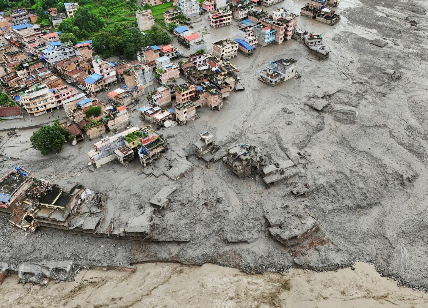
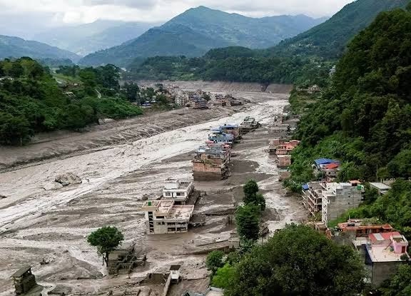
If you’ve ever stood at the base of the Himalayas, you know the mountains don't play by our rules. They never have. Two days ago, on the morning of August 26, 2026, nature reminded us of that in the most brutal way possible. A terrifying wall of water, mud, and crushed boulders ripped down through the Bhote Koshi River corridor in Rasuwa. In a matter of minutes, border spots like Timure and the town of Syabrubesi—the starting point where thousands of us have laced up our boots for the Langtang Trek—were basically smashed to pieces.
Search crews are still digging through the muck. The loss of life hurts deeply, and honestly, seeing the footage online makes your stomach drop. It’s devastating.
Understandably, our phones at Nepal High Trek have been ringing off the hook. People want to know: Is Nepal done for the season? Should I just cancel my trip?
Look, I get the panic. But let's take a breath and talk straight.
Why you should visit Nepal now for trekking?
Canceling your flight out of fear doesn't just rob you of seeing these mountains it cuts the legs out from under the porters, guides, and lodge owners who depend on this season to survive.
The mountains threw a punch at one isolated valley on the border. That's the raw reality of climate change and shifting glaciers in the high Himalayas. But Nepal itself isn't broken. Everest is waiting. Annapurna is standing tall. And for those willing to take the high pass into Langtang, the tea houses up in Kyanjin Gompa are ready to put the kettle on. Mystical Manaslu is there for all to enjoy spiritual Himalayan beauty.
What Actually Triggered the Chaos?
Early reports pointed toward a classic glacial lake outburst (a GLOF) or a stray tremor up north. But once the satellite scans came through from the USGS and international geologists, the real picture emerged—and it was wilder than anyone thought.
Way up at 5,200 meters across the border in Tibet, a massive block of glacier ice and rock—around 0.2 square kilometers of frozen slab just sheared right off the mountain face. It plummeted nearly 1.2 kilometers straight down into the Lhende Khola valley. That kind of dead weight slamming into the earth registered as a 5.2 magnitude seismic event on monitors.
When you drop a mountain of ice from that height, it doesn't just stay in chunks. It pulverizes on impact, melts almost instantly under pure friction, picks up tons of loose moraine sediment, and turns into high-speed liquid concrete.
By 8:37 AM, that wall of gray slurry crossed into Nepal. Downstream on the Trishuli, the river shot up nine whole meters in less than half an hour.
It was unstoppable. The torrent ripped apart sections of the 42-kilometer highway to Rasuwagadhi, wiped out the "Miteri" Friendship Bridge at the border, wrecked parts of the Chilime hydropower setup, and tore right through Syabrubesi's riverbanks.
7 Days Annapurna Base Camp Trek
View detailsWhere Does This Leave the Langtang Trek?
Right now, the regular bottom road to Syabrubesi is simply gone. That’s the hard truth. Does that mean Langtang is dead? No. Not even close. Remember, the high alpine heart of the valley places like Lama Hotel, Langtang Village, and Kyanjin Gompa sits way up above the flood zone. The actual dilemma is just how to get up there without using the broken lower gorge.
Here's the workaround: we head in via the Gosaikunda trail from Sundarijal. Well, some may argue with us that in the middle of this chaos we are asking people to visit Nepal. It is true! We rely on tourism but we also care about safety of our guests. We assure you that Nepalese people never lie in a extent that it costs human life. In fact, we are known across the globe as fierce fighters who save people in time of need. Therefore, if we are saying that Nepal Remains Safe for trekking, then it is safe and we can provide you safe alternatives to do the Langtang Valley Trek as well.
Instead of riding a jeep into the river canyon, you start right at the edge of Kathmandu. You hike up through the ridge forests of Chisapani, cross over the high country of Kutumsang and Tharepati, pass the sacred blue waters of Gosaikunda Lake, and drop over the Lauribina La Pass (4,610m) straight into upper Langtang. It adds extra days and demands stronger legs, sure, but you stay high on the ridges, totally clear of the riverbeds.
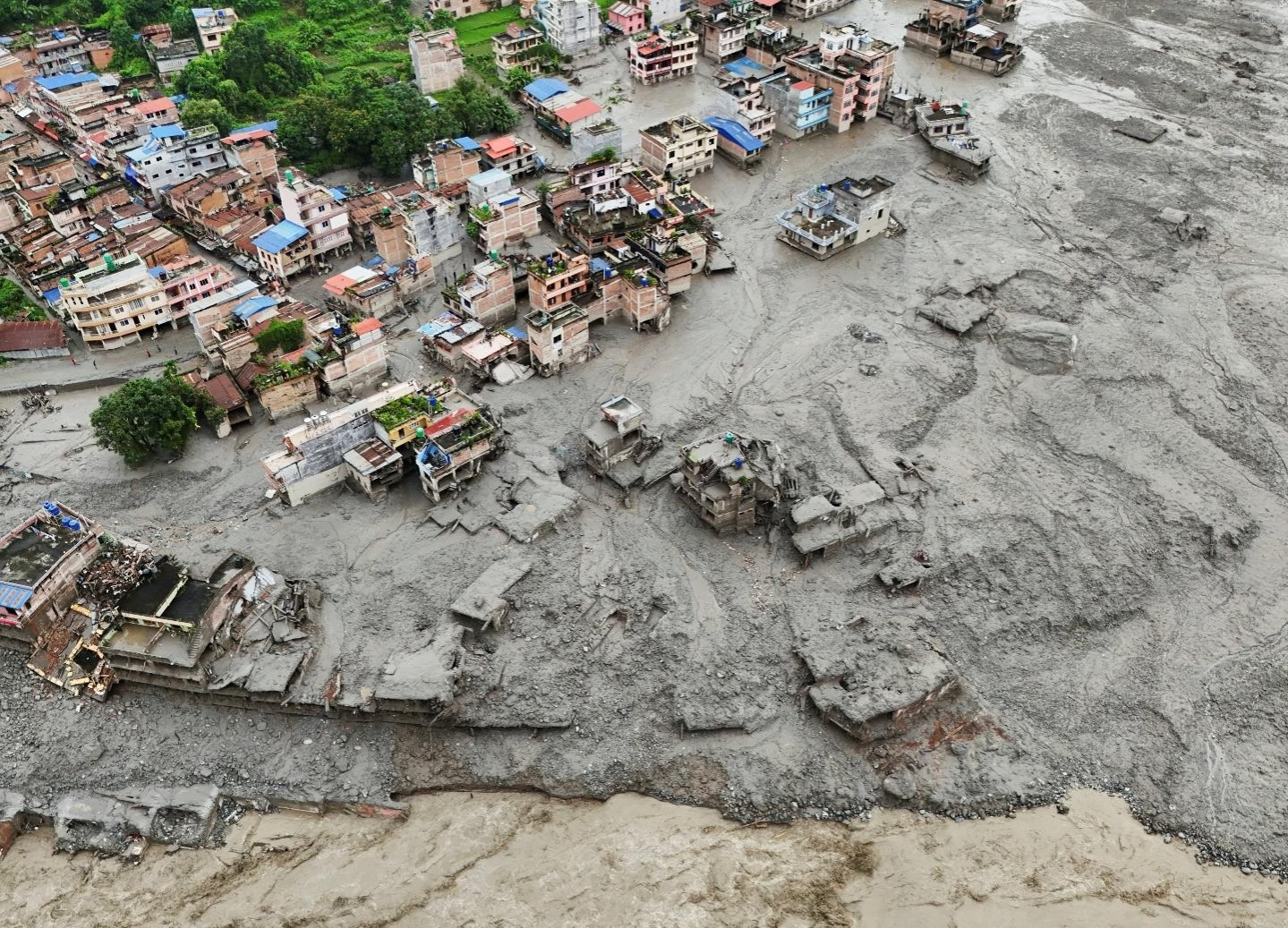
The Toll on Ground Zero
The human numbers coming in right now are gut-wrenching. As of August 28, search teams have counted 469 dead—389 on our side of the border in Nepal and 3 in Tibet. But the missing list is what keeps everyone up at night. Over a thousand people simply vanished when that wave hit, with around 644 unaccounted for in Nepal and nearly 560 across the ridge.
It hit everybody. Local shopkeepers in Timure. Families in Syabrubesi who ran tea stalls for generations. A massive group of Indian pilgrims heading up to Mount Kailash and Lake Mansarovar got caught right on the road when the water surged. Customs officers and engineers at the Chilime hydro intake didn't stand a chance when the river swallowed their stations whole. Right now, the Nepali Army and Armed Police are flying helicopters into spots where the mud is neck-deep, trying to pull survivors out. It is gritty, agonizing work.
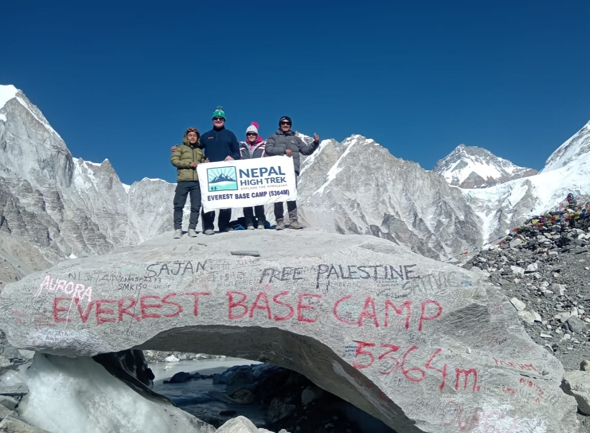
Everest Base Camp Trek: Leave Your Footprint at the World’s Tallest Base Camp
View detailsWhy Glaciers Are Breaking Apart ?
You can't talk about this flood without talking about the climate mess behind it. This wasn't bad luck. It’s part of a much uglier pattern across the high country. The Himalayas are heating up at nearly twice the pace of the rest of the planet. Over the last thirty years, Nepal’s peaks lost nearly a third of their total ice volume. Between 2011 and 2020 alone, ice melt sped up by 65 percent compared to the decade before that.
Think about what heat does to a hanging glacier at 5,000 meters. The day before this disaster, satellite shots showed pure white snowfields. Twelve hours later, record-high daytime heat melted that cover clean off, exposing bare, black ice underneath. When that foundation turns slick and brittle, whole mountain flanks lose their grip and collapse.
On top of that, you have over a thousand fragile glacial lakes trapped behind loose dirt walls in Tibet. Chinese researchers recently flagged nearly two hundred of them as extreme outburst risks.
Here’s the catch, when an ice cliff drops over the border, it takes barely twenty minutes for the slurry to hit Nepali villages downstream. We don't have hours. Without instant, automated alert sensors hooked up between China and Nepal, people in the valley floor are practically sitting ducks.
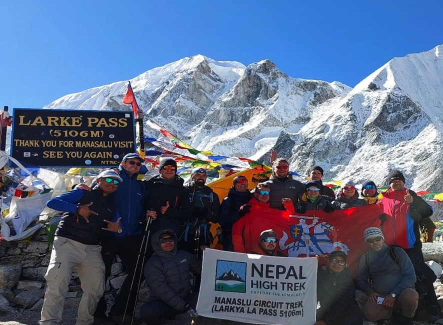
Manaslu Circuit Trek
View detailsWhat Syabrubesi's Loss Means for Langtang?
For anyone who’s ever hiked Langtang, Syabrubesi holds a soft spot. It was always that chaotic, colorful hub where you jumped off a rickety bus, grabbed a hot plate of dal bhat, crossed the suspension bridge, and started walking uphill into the pines. That bridge is gone. The trailhead road hugging the riverbed is completely ripped out.
Naturally, this puts the whole Langtang season in a bind. Up in the higher alpine basin—around Lama Hotel, Langtang Village, and Kyanjin Gompa the lodges are physically fine because they sit way above the Bhote Koshi floor. The real headache is simply that the front door got locked shut.
A lot of travel agencies started canceling trips immediately. But honestly? Walking away from Langtang right now is the worst thing we could do. These communities rebuilt every single stone house after the 2015 earthquake with their bare hands. They survive on trekkers. Giving up on them because one road washed out isn't the answer.
The Workaround: Taking the High Pass via Gosaikunda
So how do you actually reach Kyanjin Gompa now? You don't take the river road. You take the high ridge trail.
We route you straight out of the Kathmandu Valley from Sundarijal. You walk right past the reservoir, climb into the cool oak forests of Shivapuri, and overnight in Chisapani with early-morning views of the snow peaks. From there, the trail stays high along the ridges through Kutumsang, Tharepati, and Ghopte.
You aren't anywhere near flood gorges here. You're walking on open mountaintops. Eventually, you climb up to the sacred alpine waters of Gosaikunda Lake at 4,380 meters, push up over the Lauribina La Pass at 4,610 meters, and drop down directly into the upper Langtang corridor near Thulo Syabru.
Sure, your calves will burn more. It adds three or four extra days to the standard itinerary. But honestly, it’s a far better trek. You get the quiet forests of Helambu, the spiritual chill of the holy lakes, and the massive snowy bowl of Kyanjin Gompa all wrapped into one safe loop.
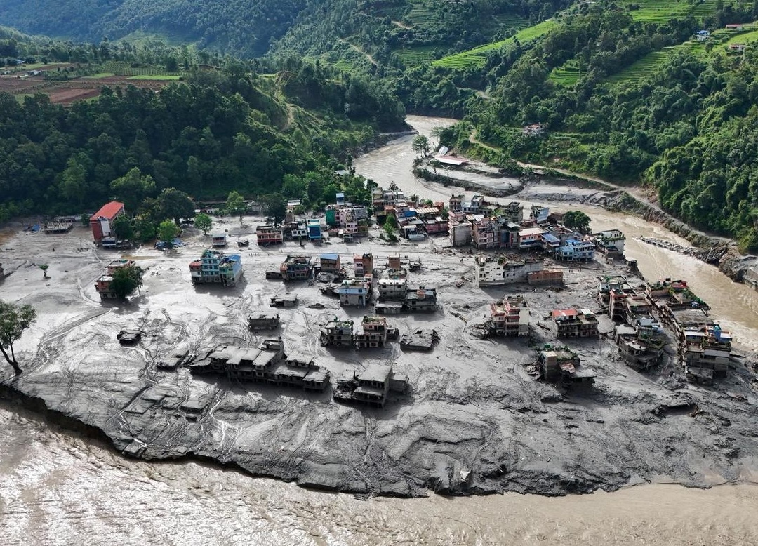
Let’s Put Your Safety Worries to Rest
When international news channels blast red-banner headlines about a flood in Nepal, people picture the entire country underwater. That is just bad geography.
Nepal is a maze of giant, isolated valleys separated by massive physical mountain walls. A mudslide in the Bhote Koshi canyon has zero physical connection to what's happening in the Khumbu or the Annapurna range.
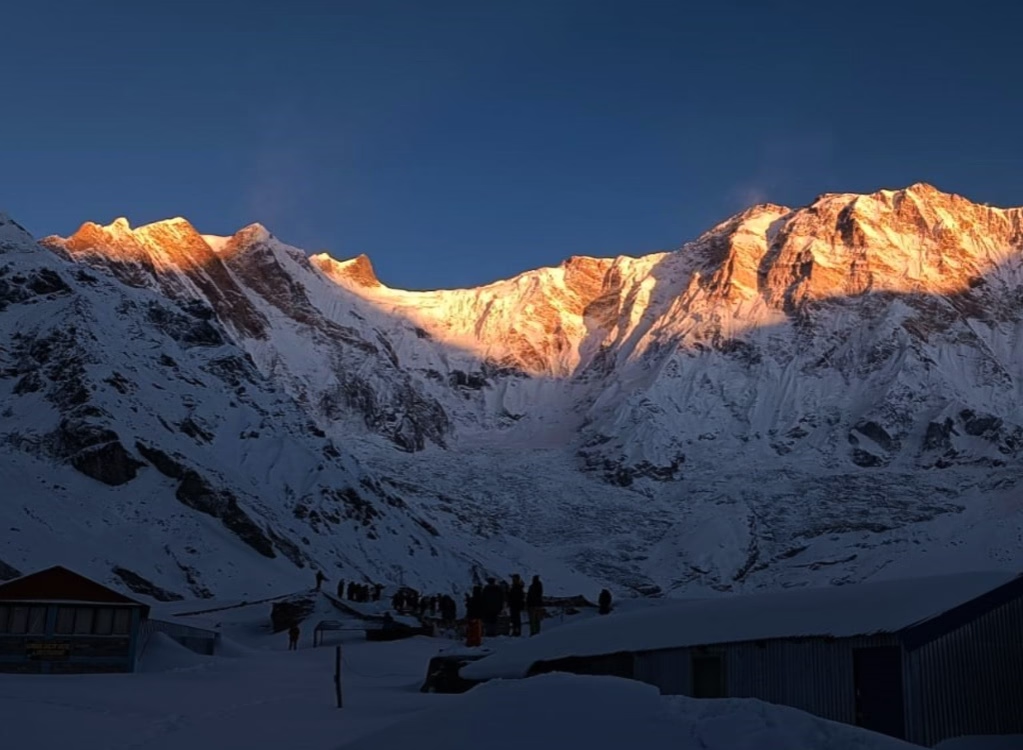
If you are booked for Everest Base Camp, you are hundreds of miles east. Flights into Lukla are landing on schedule, the Dudh Koshi trails are dry, and the teahouse chimneys are smoking as usual.
If you're heading to the Annapurna Circuit or ABC, Pokhara is sunny and the mountain trails westward are untouched. The same goes for the Manaslu Circuit; its river system is in a totally different drainage basin. Over 95% of Nepal’s trekking map is completely clear and open for business.
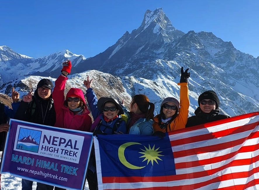
Mardi Himal Trek
View detailsWhy Staying Home Actually Hurts More?
When disasters hit, the knee-jerk instinct for tourists is to pull the plug and stay home. But when you cancel a trip to Everest or Annapurna because of an isolated incident in Rasuwa, you end up hurting the wrong people.
Nepal runs on trekking. The porter carrying your duffel, the guide pointing out peaks, the family growing potatoes for your dinner they bank on these few months of the season to pay school fees and buy winter supplies. Visiting Nepal right now is how you actually help. You put money directly into hands that need it, keeping the backbone of the mountain economy strong while the lower border towns get rebuilt.
The high peaks haven't gone anywhere. The trails across Everest, Annapurna, and the Manaslu are solid, quiet, and ready for you. Lace up, come over, and let's go trekking.
Do you need an update on current trail conditions? Drop a message or call to the travel planners of the Nepal High Trek we're out on these trails every single day.
Nepal High Trek
Travel writer and passionate explorer sharing stories and expert guides from the heart of the Himalaya.